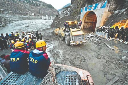
'U'khand disaster was caused by massive rock and ice avalanche'

New Delhi: The February 7 disaster in the Chamoli district of Uttarakhand, that resulted in over 200 dead or missing, was the result of an avalanche that dropped about 27 million cubic metres of rock and glacier ice from the nearby Ronti Peak, according to a study by an international team of researchers.
The region experienced a humanitarian tragedy on February 7 this year, when a wall of debris and water barrelled down the Ronti Gad, Rishiganga and Dhauliganga river valleys. To investigate the cause, scope, and impacts of the disaster, a global team of 53 scientists came together in the days following the tragedy.
The researchers, including those from Jawaharlal Nehru University in New Delhi and Indian Institute of Technology Indore, determined that the flood was caused by falling rock and glacier ice that melted on its descent, and not by a lake or diverted river.
The study, published in the journal Science on Thursday, suggests that climate change is contributing to such events happening more frequently, and highlights risks of increasing development projects in fragile environments.
The rock and ice avalanche rapidly transformed into an extraordinarily large and mobile debris flow that transported boulders 20 metres in diameter, and scoured the valley walls up to 220 metres above the valley floor, the researchers said.
The finding will help researchers and policy makers better identify emerging hazards in the region. The study used satellite imagery, seismic records, and eyewitness videos to produce computer models of the flow. Initial hypotheses for the cause of the event suggested a glacial lake outburst flood.
However, there are no glacial lakes large enough to produce a flood anywhere near the site, the researchers noted.
"Our access to high-resolution satellite imagery and research software, and our expertise in satellite remote sensing were crucial to get a bird's-eye view of how the event unfolded," said study co-author ShashankBhushan, a doctoral student at the University of Washington in the US.
"We worked with our French collaborators to coordinate satellite collections within days of the event and rapidly process the images to derive detailed topographic maps of the site," Bhushan said.
The team compared the images and topographic maps from before and after the event to document all of the changes and reconstruct the sequence of events. "We tracked a plume of dust and water to a conspicuous dark patch high on a steep slope," said study lead author Dan Shugar, associate professor at the University of Calgary in Canada.


