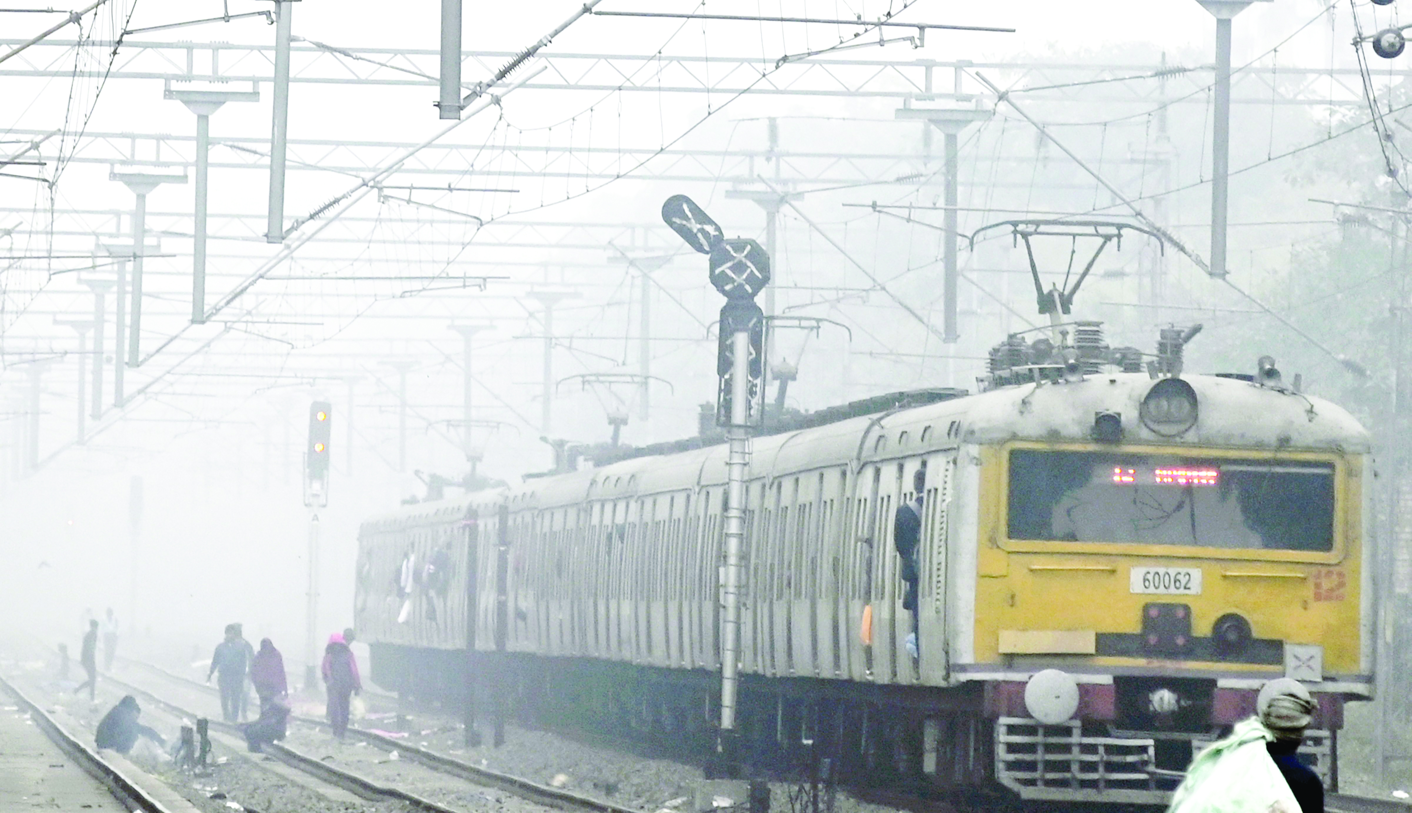
Fog disrupts travel in north, northeast India

New Delhi: Dense fog significantly reduced visibility in various parts of north and northeast India on Thursday, causing substantial disruptions to road, rail, and air traffic. The India Meteorological Department (IMD) anticipates similar conditions persisting for the next five days.
According to officials, 18 Delhi-bound trains were delayed by up to six hours due to foggy weather. Ranchi’s Birsa Munda Airport saw 14 flight cancellations due to dense fog while four flights were diverted at Delhi’s IGI Airport, they said.
Satellite imagery indicated a slight reduction in fog over Bihar and eastern Uttar Pradesh, but ‘dense’ to ‘very dense’ fog persisted in Punjab, Haryana, west Rajasthan, Bihar, Delhi, west Uttar Pradesh, Jharkhand, Odisha, and Assam, according to the IMD.
Rainfall occurred in Arunachal Pradesh and parts of West Bengal, with isolated areas in the northeast, Bihar, Jharkhand, Chhattisgarh, Odisha, Tamil Nadu, and Puducherry experiencing precipitation.
In Tamil Nadu, the Nilgiris district witnessed a drop in temperatures, causing concern among environmental activists about the ‘unseasonal’ cold affecting farming. Temperatures plummeted to 1 degree Celsius at Kanthal and Thalaikuntha in Udhagamandalam, also known as Ooty.
The Jharkhand government adjusted school timings until January 25 due to severe cold conditions. Students from kindergarten to Class 5 will attend from 10 am to 2 pm, and students from Class 6 to 12 will attend from 9 am to 3 pm.
In the northern regions, a predominantly dry and snowless winter persisted in Kashmir, with cold wave conditions in Punjab and Haryana. Higher reaches of Himachal Pradesh’s Shimla district experienced light snowfall in isolated places.
The IMD forecasted ‘dense’ to ‘very dense’ fog and ‘cold day’ to ‘severe cold day’ conditions in North India for the next five days.
A “yellow alert” for dense fog was issued for Delhi over the next two days, with temperatures ranging from 6.6 to 18.6 degrees Celsius.
In Jammu and Kashmir, the cold wave intensified, with Srinagar recording minus 4.6 degrees Celsius.
The prolonged dry spell in Kashmir resulted in freezing nights and warmer-than-usual days, with a 79 per cent rainfall deficit in December.
Punjab and Haryana experienced below-normal temperatures, with widespread fog in many areas.
In Himachal Pradesh, Shimla’s higher reaches received light snowfall, while the meteorological station warned of dense fog in the lower hills on January 19.
Severe cold gripped many parts of Uttar Pradesh, and Moradabad recorded the lowest temperature at five degrees Celsius.
Parts of Rajasthan saw some relief from the cold during the day, but ‘dense’ to ‘very dense’ fog persisted in various places.
The western Himalayan region experienced an 80 per cent precipitation deficit in December, and January has remained notably dry, with the IMD attributing this to the absence of active western disturbances in the current winter season.
The dearth of active western disturbances—weather systems originating in the Mediterranean and causing unseasonal rainfall in northwest India—is also the cause of the persistent dense fog covering the plains in the region since December 25, as stated by the IMD on Thursday.
The precipitation shortage is expected to impact freshwater availability in the Himalayan region, consequently affecting horticulture and agricultural production, according to Sonam Lotus, the head of the meteorological center in Leh, Ladakh.
He expressed concern over the unusual warmth in Ladakh and Kashmir during peak winter, causing early blooming of crops.
Raihana Habib Kanth, Dean of Agriculture at Sher-e-Kashmir University of Agricultural Sciences and Technology of Kashmir, highlighted that snowfall during the Chillai Kalan period (December 21 to January 29) serves as the primary freshwater source for the region before the onset of the southwest monsoon. The prolonged dry spell has led to a reduction in water levels in rivers and streams.
A report authored by IMD scientists Krishna Mishra, Naresh Kumar, and RK Jenamani highlighted that maximum temperatures have been 5-8 degrees Celsius below normal over the northern plains since December 29, with a brief respite on January 7-8 due to a western disturbance. Minimum temperatures dropped below 4 degrees Celsius at many stations in the region from January 12 to 17.
The report noted that very dense fog has persisted over the plains of northwest India since December 25, reaching its peak intensity and duration on January 14 when visibility dropped to zero meters across Haryana, Delhi, Uttar Pradesh, and Bihar.
The severe weather in north India is primarily attributed to the absence of active western disturbances, prevailing El-Nino conditions, and a strong jet stream, according to the scientists.
The lack of precipitation in the western Himalayan region during December, approximately 80 percent less than normal, is a consequence of the absence of strong western disturbances.
The prevailing El-Nino conditions, characterised by abnormal warming of surface waters in the central Pacific Ocean, contribute to fewer cold wave days over north India during December and January.
The scientists also highlighted that strong jet streams over north India for the last five days enhance cold wave/cold day conditions, with these conditions expected to continue over the next five days. with agency inputs


