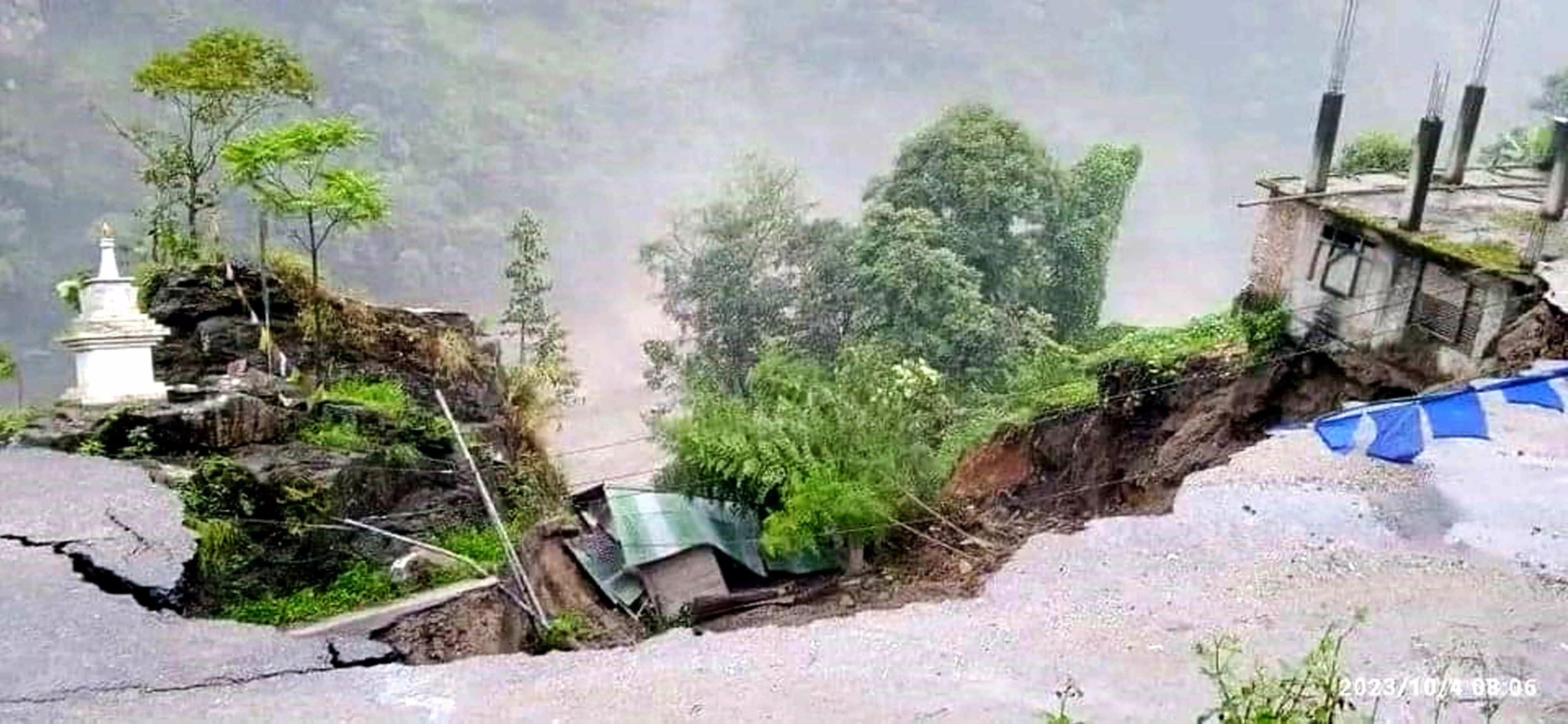
‘Teesta disaster was waiting to happen’

Darjeeling: A publication by the National Management Authority in October 2020 had clearly mentioned that glacial lake outburst floods (GLOF) risk to the population is highest in Sikkim and Jammu and Kashmir and “threat to hydropower (from GLOF) is the highest in Sikkim.” The Sikkim disaster which unfolded in the wee hours of Wednesday was a textbook example of this. As per the Sikkim government figures on Thursday, 19 bodies were recovered, including that of 6 Army personnel, 103 persons are reported missing and 26 injured.
At around 1 am, a GLOF at the Lhonak Lake resulted in Teesta Urja (at present Sikkim Urja) Dam being breached at Chungthang in North Sikkim resulting in widespread devastation downstream in both the state of Sikkim and West Bengal.
Teesta Urja is the largest hydro power project in Sikkim generating 1200 MW. Sunil Saraogi, the executive chairman of Sikkim Urja Limited stated that such was the force of the water that the Chungthang Dam was washed away in around ten minutes along with the 200 metre-long bridge connecting the power house to the dam.
As per the National Hydropower Development Corporation (NHDC), 47 hydropower projects are in different development stages on the Teesta in Sikkim and West Bengal. Work on 15 projects are on with 28 in the pipeline while nine have already been commissioned.
A study in 2022 by Sayantan Samui and Narayan Sethi clearly states that Chungthang town in North Sikkim where the Teesta Urja (at present the Sikkim Urja) Dam is located is “situated close to all the ‘hugely susceptible’ lakes” and “lying at terrible risk to the future GLOFs in the entire upper Teesta catchment.”
The study states that many settlements at Chungthang are potentially exposed to the future GLOF of South Lhonak Lake, one of the fastest growing glacial lakes in India.
“The flooding in the Teesta river was caused by excess rainfall and a GLOF event at South Lhonak lake. The dams in the region Teesta V or the Chungthang Dam’s design, couldn’t withstand the water pressures. Indicator of hydraulic alteration analysis (analysis of the flow of the river) in 2010 showed, post construction of the dams, higher events and magnitude of flooding and very low flow (drought) events in the river in Sikkim,” stated Kausila Timsina while talking to Millennium Post. She has done a study on “Assessment of the Catchment Flow Variability of Teesta River Basin in Sikkim.”
The Teesta river basin area in Northern Sikkim is mostly in 30 to 60 per cent slope and has an extreme elevation from 280 metre to 8568 metre. “Thus the steep slope, erosive soil and the geology risks for landslides aggravated by development of large hydropower projects and other infrastructures, these infrastructure development needs a holistic policy for the Teesta basin and other Himalayan catchments,” she added. Catchment flow studies in the Himalayas are not only crucial for volume of flow, but also other landscape components such as, biodiversity, landscapes, geology, sediment generation, including socio-economics in all parts of the basin.
“The fragile Himalayan climatic conditions, its geography and geological system may not be able to withstand the extreme weather conditions and thus needs a better evaluation before construction of any infrastructure like dams, roads and railways through the mountains that disturb the geology,” suggested the climate and water resources researcher.
A statement from ISRO confirmed the GLOF event of the South Lhonak Lake. The satellite image-based study on the outburst of the South Lhonak Lake, Sikkim by obtaining temporal satellite images (before and after) over the lake states: “It is observed that Lake had burst and about 105 hectares area has been drained out (28 September image versus October 4) which might have created a flash flood downstream. ISRO will continue monitoring the lake further using satellite data.”
“This is not the last of such incidents triggered by the River Teesta. If people continue exploiting nature irresponsibly, the future would witness many more such incidents of greater magnitudes,” feels Professor Jeta Sankrityayana. The professor is a former member of the State Planning Board, West Bengal and a member of the expert committee on landslide 1998.
“When the Teesta dams were proposed there were ample studies to suggest that these events would occur. This is not an unknown scenario. It will occur again and again if people don’t pay heed and try to harness nature in an irresponsible manner. This is at a cost of human lives and financial loss borne by the region,” added the Professor.
The committee on landslides, that Professor Jeta Sankrityayana was part of had also studied the tectonic plate movement and had handed over recommendations to the Government of West Bengal in 2000. The recommendation stated that no construction should be allowed on this river. “The Himalayas are a young chain of mountains formed by the Indian tectonic plate colliding with the Eurasian plate. While the river Teesta flows in a north-south direction, the Himalayan fault lines lie in the east-west direction. A major fault line is located at Kalijhora in West Bengal and Teesta Low Dam stage 4 is located here,” added the Professor.
As a 13-year-old boy, he witnessed the devastation in 1968 caused by flash floods on Teesta coupled with landslides and tremors. “It had happened around this time during Durga Puja. The Teesta Bridge was washed away and we were stranded in Kalimpong for three weeks. Food was in short supply and was airdropped. These events occur continuously on the Teesta, just that it is more devastating each time,” added the Professor.
In 1968, the region of Sikkim and Darjeeling received incessant rainfall for four days between October 2-5, triggering flash floods and landslides. Houses and bridges were washed away with around a thousand people dead.


